
Sierra Nevada de Santa Marta, Colombia — August 2026. What began as a one-year effort to strengthen forest monitoring has become a community-managed system for protecting 9,800 hectares of Narakajmanta ancestral forest. Through the ETHNO-PROGRAM FOR CLIMATE MANAGEMENT OF FOREST IN THE COLOMBIAN ANDEAN MOUNTAINS, implemented by Environmental Women Org with support from the Global Forest Watch Small Grants Fund, we combined satellite information with Indigenous territorial knowledge to shorten the distance between detecting a threat and acting on it.
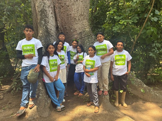
Indigenous Narakajmanta monitors use Global Forest Watch tools to connect satellite information with territorial knowledge in the Sierra Nevada de Santa Marta.
At the start of the project, forest surveillance relied largely on direct observation, walking patrols and radio communication. By August 2026, GLAD deforestation alerts and VIIRS fire signals were guiding where monitoring teams looked first. MapBuilder provided territorial context, while Forest Watcher allowed monitors to work in areas where mobile connectivity disappears.
Technical Comparative Diagnosis of Narakajmanta Forest Monitoring 2025–2026
Baseline-to-August 2026 assessment documenting the transformation of the community forest-monitoring system.
From 9,800 hectares to precise field decisions
We maintained monitoring across the full 9,800 hectares, while concentrating intensified surveillance on 980 hectares identified as higher risk. Five community brigades comprising 50 trained monitors converted satellite signals into field evidence through photographs, GPS coordinates and incident records. By project close, at least 90% of prioritized alerts had been verified, and the monitoring system had accumulated 300 georeferenced incident records.
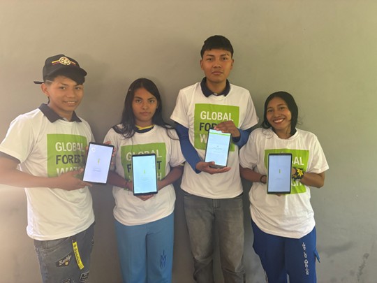
Five community brigades strengthened the connection between satellite alerts and direct field verification across Narakajmanta territory.
Operational Manual for Community Forest Monitoring with Global Forest Watch
Practical field guidance covering alert reception, MapBuilder analysis, Forest Watcher offline use, GPS evidence, synchronization and incident documentation.
Women and youth moved from trainees to decision-makers
Technology alone did not produce this result. We trained 300 Narakajmanta women, girls and LGTBI people to use Global Forest Watch tools and participate in forest stewardship decisions. During implementation, women and younger monitors increasingly moved from receiving technical information to interpreting alerts and proposing patrol routes.
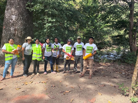
The project strengthened technical leadership among 300 Narakajmanta women, girls and LGTBI participants, linking climate resilience with Indigenous forest governance.
A 48-hour community response system
We also consolidated 10 community early-warning and response procedures. Priority alerts now move through a defined chain from technical screening to brigade assignment, field verification and documented closure, with a maximum operational standard of 48 hours. Ten wildfire-response kits and associated firebreak areas strengthen preparedness across approximately 1,000 hectares of critical forest.
Community Early Warning and Response Protocol for Deforestation and Forest Fires
Master protocol integrating the 10 response procedures, alert levels, responsibilities, communication routes and the 48-hour response standard.
The project reports a 95% reduction in illegal-deforestation alerts and climate-induced fire outbreaks in high-risk intervention zones compared with the project baseline. Among 300 participating households, 60% adopted sustainable land-management practices and slash-and-burn activity was reported to have fallen by 50%.
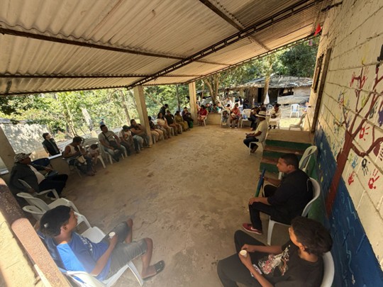
The monitoring system connects technology, community prevention and Indigenous governance to protect Narakajmanta ancestral forest.
What happens after the grant?
The work now enters a new phase. The Narakajmanta Indigenous Environmental Secretariat will carry the system forward through 2030. Its mandate is to maintain surveillance of the 9,800 hectares, coordinate monthly alert reviews and ensure that monitoring evidence continues to inform decisions made by the Narakajmanta Indigenous Tribal Council.
Narakajmanta Strategic Forest Monitoring and Governance Plan 2026–2030
Post-grant roadmap for maintaining community surveillance, GFW administration, patrol coordination, evidence governance and institutional sustainability through 2030.
+ There are no comments
Add yours